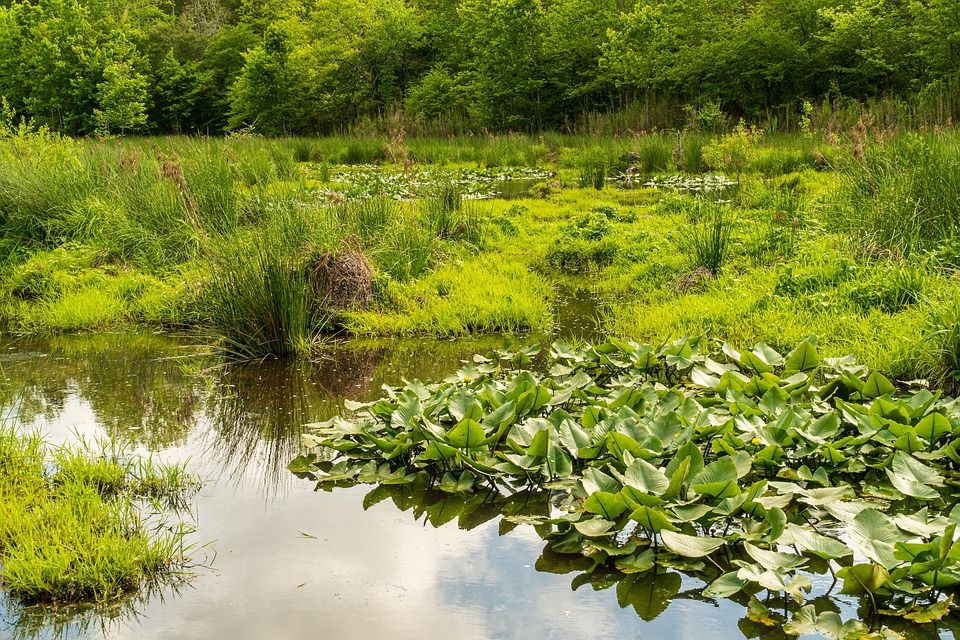
The economic stake first. In Bure and Womberma, two woredas in northwestern Ethiopia, a wetland is not scenery; it is a balance sheet, paying out “water, food, and building materials” plus “flood control, climate regulation, and cultural significance” on one side, and on the other, land that could grow maize this season. The 2026 accounting from both sides of that ledger is stark. A survey-based study published July 2 in PLOS One found 48% of the wetlands it examined turned into farmland across the past 36 years. A satellite study published October 20 in Discover Environment, watching the same districts from orbit between 1985 and 2020, counted the swap directly: water body down 63.2%, wetland down 29%, while cultivated land expanded by 39.8%, settlement by 280.6% and eucalyptus plantation by 380%, all “at the expense of wetland, woodland, and shrubland”
The backdrop is continental. Wetlands are “the vital landscapes of the earth’s surface” covering 12 to 16 million square kilometers, roughly 6% to 8% of all land on the planet, with Asia holding 32% of the global share and North America 27%, and African wetlands about a tenth of the world total, “making the continent a major contributor to these crucial ecosystems” They are also, the literature agrees, “declining at alarming rates faster than any other ecosystems” The global natural wetland area shrank by roughly 35% between 1970 and 2015, and agriculture takes the largest single slice, 25%, of global wetland loss. Ethiopia carries the same exposure: 26,424 square kilometers, or 2% of its land area, is wetland, and the country lost 20% of its freshwater wetland coverage between 2000 and 2020. Micro-level studies put farmland expansion behind 20-90% of wetland decline across three decades, and the PLOS One authors write that “the conversion of wetlands to farmland accounts for the vast majority” of the loss nationwide.
Data shows the conversion is not ignorance; it is arithmetic. The PLOS One team, working from Landsat imagery, questionnaire surveys and interviews with key informants, reports that even while acknowledging what wetlands deliver directly and indirectly, most respondents “have preferred transforming wetlands into farmland” An ordered probit model tied the desire to convert to household age, “asset holding size (land and livestock)” and livelihood strategy, crop farming or non-farm. The officials’ side of the story is institutional: youth pressure and job-creation goals have driven a “distribution of wetlands to unemployed graduates and landless households” And the transaction, the authors find, skips its environmental due diligence entirely, since “the environmental soundness of wetlands cultivation has not been considered”
The theory behind the drain is older than the satellites. The PLOS One paper frames the debate among three perspectives, “tragedy of the commons, Maslow’s Hierarchy of Needs and institutional theory” The first blames self-interested individuals exploiting a shared resource in “the absence of clear-cut and strictly followed rules of engagement” the second says subsistence-level households must discount the future, and the third locates the failure in institutions, holding that “resource degradation stems from institutional failures” in policy, law, organization and custom. The evidence leans institutional: prior work has found “the communal wetlands are better managed than the privatized wetlands” and one cited driver is simply perception, with some studies reporting that “perceiving wetlands as “wastelands” is the principal factor for their conversion” Others point to the premium on immediate benefits over long-term ecosystem value, to human-wildlife conflict from crop-raiding primates and livestock predators, and to missing comprehensive wetland policy frameworks.
The satellite study supplies the physical audit for the same ground. The Foket floodplain, part of the Upper Blue Nile basin, straddles the Fetam River inside the same Bure and Wonberma woredas; its economy runs on “subsistence mixed crop-livestock farming” with wheat and maize the principal cereals. The Springer team classified cloud-free Landsat scenes from 1985, 2002 and 2020 into eight land-cover classes, ran the Global Surface Water Explorer across 1984-2020 and tracked vegetation with NDVI. The findings line up with the survey work: surface-water dynamics show “a substantial decline in seasonally inundated areas” and reduced hydrological connectivity. The vegetation index recorded “a significant increasing of wetland vegetation” growth running fast to 2000, slower through 2012 and slightly down by 2020/21. The climate test is the tell: the catchment shows “no major change in annual rainfall or evapotranspiration” while “temperature exhibited a significant upward trend” meaning land use, not weather, is doing the damage. The wider catchment numbers frame the pressure: 1120.5 square kilometers of drainage, a population projected at 795,826 in 2024, density of 214 people per square kilometer against a national 127, and cropland already 61% of the land.
The prescriptions from both papers read like a reform agenda for a resource economy. The PLOS One authors want employment outside farming expanded, warning of the “heavy reliance of rural people on wetland farming” and calling it “imperative to execute agro-ecological evaluation prior to converting wetlands into farmland” The satellite paper closes on the “urgent need for integrated management interventions that regulate agricultural expansion, grazing, and water diversion while maintaining hydrological connectivity and wetland vegetation” For a district where settlement has nearly quadrupled its footprint and eucalyptus has almost quintupled, the trade is plain: each converted hectare buys this year’s harvest and spends the flood control, the water and the soil moisture that the next one depends on. Data shows which way the ledger is running.
Sources
- Wetland conversion to farmland in Bure and Womberma Woredas, Northwestern Ethiopia: Implications for sustainable land use | PLOS One
- Wetland vegetation dynamics and its linkage with climatic, hydrological, and land-use/ land cover changes in the Foket floodplain of the Fetam River Watershed, Northwestern Ethiopia | Discover Environ